230
230
tv
eye 230
favorite 0
quote 0
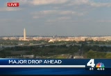
we're seeing the mercury drop. we're going to see some chilly air coming in with a cold front. a mighty strong cold front. so that's the first time you'll notice that change coming. so throughout the day on saturday, it's not going to be a big change coming just yet. when this front comes through, with some rain, you'll notice a 10-150 degrees drop in the mercury. so, again, saturday night, some chilly air. here we are for tomorrow morning dropping to 55 degrees and around mt. airy. down south, around fredericksburg, starting out at around 59 degrees. that really is about seasonal for this area. here's what's going to happen. we've got that cold front springing areas to the west. it's not going to have as much rain with it. we'll see a few showers with a 30% chance of a few scattered showers. the main thing with that front is the colder air that will be coming in. and then on sunday, tracking the low pressure that will be making its way northward. there will be some scattered showers around on sunday afternoon and then a little bit more rain coming in cold. 37 frederick, 38 in
we're seeing the mercury drop. we're going to see some chilly air coming in with a cold front. a mighty strong cold front. so that's the first time you'll notice that change coming. so throughout the day on saturday, it's not going to be a big change coming just yet. when this front comes through, with some rain, you'll notice a 10-150 degrees drop in the mercury. so, again, saturday night, some chilly air. here we are for tomorrow morning dropping to 55 degrees and around mt. airy. down south,...
134
134
Oct 10, 2012
10/12
by
WTTG
tv
eye 134
favorite 0
quote 0
a new study found low levels of mercury can increase the chances of adhd symptoms. moms to be who ate more fish had children with fewer signs of adhd. doctors say eat fish, but make sure it is low in mercury. >>> and number one tonight, facebook's like button has some competition. the social network is testing out a want button. it allows users to create wish lists of products they would like to buy. those lists will be shown on a user's time line. pottery barn and victoria's secret are participating. and brian, that's tonight's fox 5 top 5. >> maybe today was the turning point for the week. >> i think it is. we are going to have cool days, brian. a little bit up and down. it's mostly a great trend we are on and going to be a lot brighter than it has been the past couple of days. tonight, we have the clouds hanging tough. don't be shocked if you get drizzle on the windshield if you are driving later tonight. and maybe a few patches of fog here and there, but all things considered, we are mostly done with the rain for a while and the next number of days are going to
a new study found low levels of mercury can increase the chances of adhd symptoms. moms to be who ate more fish had children with fewer signs of adhd. doctors say eat fish, but make sure it is low in mercury. >>> and number one tonight, facebook's like button has some competition. the social network is testing out a want button. it allows users to create wish lists of products they would like to buy. those lists will be shown on a user's time line. pottery barn and victoria's secret...
117
117
Oct 16, 2012
10/12
by
WUSA
tv
eye 117
favorite 0
quote 0
winds are calm, but the pressure is going up at 29.90 inches of mercury. all right, satellite picture, radar combined, we have showers in the northern rockies, and actually shammers showers in the great lakes. this is where it is now. tomorrow, we're fine. in fact, ahead of it we're going to get milder air. but this cold front on thursday evening could give us showers, just in time for the evening commute. might give us a couple thunderstorms on thursday as well. in the meantime, clear skies right now. a few clouds back to the south and west. so we'll keep it clear to partly cloudy all night. you can't go almost clear, because it clears an absolute. i get e-mails about that. 50 in gaithersburg, 55 in great falls. some areas in the low 50s. 53 in fairfax. 56 in arlington. even college park now in the upper 50s and bowie in the mid 50s. so, nice fall pattern. a light jacket tonight. a good idea. milder tomorrow. you might want to grab the umbrella and get it handy for thursday evening. good news is, it will be mild on thursday. for tonight, clear to partly c
winds are calm, but the pressure is going up at 29.90 inches of mercury. all right, satellite picture, radar combined, we have showers in the northern rockies, and actually shammers showers in the great lakes. this is where it is now. tomorrow, we're fine. in fact, ahead of it we're going to get milder air. but this cold front on thursday evening could give us showers, just in time for the evening commute. might give us a couple thunderstorms on thursday as well. in the meantime, clear skies...
56
56
Oct 22, 2012
10/12
by
WMAR
tv
eye 56
favorite 0
quote 0
jimmy tells police that he had been partying, and he left his car at the lincoln-mercury dealership close by and was just coming to get his car back. the only problem is, jimmy's at uncle robert's used cars. he wasn't at the right dealership. >> he must have been at a heck of a party. >> do police think he's trying to steal a car. >> they don't think he was trying to steal anything and charged him with criminal trespass. the owner says all we want is about $200 to fix the sliding glass door he broke. >> i'm trying to figure out if he even knew what kind of car he had at this point. >> good thing he didn't find his car. doesn't look like he was in any condition to drive. >>> tell you what, i've never gone up to a vending machine in my life and had this cool of an experience. chck this out. unsuspecting customers at a coke zero machine. watch what happens. suddenly the violinist starts playing a james bond theme. and then you see, enter your name. >> platform six. 70 seconds to unlock the 007. >> you're becoming a 007. >> wait until you see what they have to go through to get to platform 6.
jimmy tells police that he had been partying, and he left his car at the lincoln-mercury dealership close by and was just coming to get his car back. the only problem is, jimmy's at uncle robert's used cars. he wasn't at the right dealership. >> he must have been at a heck of a party. >> do police think he's trying to steal a car. >> they don't think he was trying to steal anything and charged him with criminal trespass. the owner says all we want is about $200 to fix the...
178
178
Oct 4, 2012
10/12
by
WUSA
tv
eye 178
favorite 0
quote 0
pressure rising a little bit at 30.11 inches of mercury. we're going to zoom up to the northern sections of minnesota and eastern sections of north dakota. and they had three to five inches of snow there. the massive storm is cranking the winds too. just pow to 50 miles per hour. there is a cold front attached to that and the cold front right now west of chicago and west of st. louis. but this is going to eventually turn us very, very chilly for you. almost cold really in terms of what we have been through as we need to get into sunday. also they had make a chill hi day, but a bright and brisk day in kansas city for the ravens. we will zoom in a little bit more with some showers and clouds earlier this morning. they have gone and we are looking at clear skies and a very nice evening. temperatures, well, we are still in the 70s in many spots. 56 in gaithersburg and 59 in fairfax. 7 be in articling -- 7 be in -- 73 in arlington and 71 in bowie. >>> less humid on friday, perfect. a late shower is possible for the turps game as we may not be ab
pressure rising a little bit at 30.11 inches of mercury. we're going to zoom up to the northern sections of minnesota and eastern sections of north dakota. and they had three to five inches of snow there. the massive storm is cranking the winds too. just pow to 50 miles per hour. there is a cold front attached to that and the cold front right now west of chicago and west of st. louis. but this is going to eventually turn us very, very chilly for you. almost cold really in terms of what we have...
142
142
Oct 18, 2012
10/12
by
WUSA
tv
eye 142
favorite 0
quote 0
and the pressure is up a hair at 2924 inches of mercury. a pretty good line of showers and storms now entering extreme western virginia and exiting west virginia as they will go up through elkins into the panhandle of maryland. that's what we're worried about here. right now we have minor showers pushing through the metro area. enough for you to wet the roads as you are getting home late. and i've got some wet roads and also out here for you in loudoun county. mostly green. a little light activity showing up. temperatures in the 60s. it is mild everywhere. we're looking at 65 in rockville and great falls. 65 in vienna. a pair of 65s in fairfax and berk. mid-60s also in bowie. so now yellow alert, storms overnight. the morning commute now, it could be wet, especially from i- 95 eastward, okay. evening commute is dry. and a very warm finish to the week. ironically friday will be warmer than today. all right, here's a look at your future cast as you have the showers to the west of us. that's the light activity. but this is the line that we're
and the pressure is up a hair at 2924 inches of mercury. a pretty good line of showers and storms now entering extreme western virginia and exiting west virginia as they will go up through elkins into the panhandle of maryland. that's what we're worried about here. right now we have minor showers pushing through the metro area. enough for you to wet the roads as you are getting home late. and i've got some wet roads and also out here for you in loudoun county. mostly green. a little light...
126
126
Oct 21, 2012
10/12
by
WBAL
tv
eye 126
favorite 0
quote 0
investigators believe the woman behind the wheel of the mercury had swerved to avoid another vehicle when she drove into a parking lot and slammed into the building. no one was inside at the time, but the driver was taken to the hospital with minor injuries. officials at the learning center say they will be closed on monday. for four hours today emergency crews from all of the region were responded to a terrorist attack. this one was a drill. the urban areas security initiative have an exercise based on how quickly local emergency jurisdictions can respond to terrorism incident. the scenario was designed to be as real as possible. you can see the victims were played by real actors combined with training manikins. each first responder is given a specific role. >> when i arrive, i met with the police incident commander. and what happens is the police had a bomb they had several bombs, device and one of them exploded. at that point, it becomes a fire department operation, because now we have wounded civilians, structural stability and possibly a fire. >> we were trying to figure out whe
investigators believe the woman behind the wheel of the mercury had swerved to avoid another vehicle when she drove into a parking lot and slammed into the building. no one was inside at the time, but the driver was taken to the hospital with minor injuries. officials at the learning center say they will be closed on monday. for four hours today emergency crews from all of the region were responded to a terrorist attack. this one was a drill. the urban areas security initiative have an exercise...
117
117
Oct 17, 2012
10/12
by
WUSA
tv
eye 117
favorite 0
quote 0
pressure not moving. 25.9 inches of mercury. oh my, temperatures in the 60s. i'm going to become larger in a minute. 63 in great falls. 62 in vienna. looking at 64 in fairfax and 63 in arlington. so mainly we are talking about temperatures in the 60s pretty much across the board. showers and storms are on the way. mild and dry tonight. the morning commute will be dry tomorrow. the evening commute will be mainly dry tomorrow. the big showers and storms won't push in until after the commute. and thursday night will be wet. you have plans thursday night, allow extra time. so 8:00 in the morning on thursday, okay, we have a lot of sun, but no green blobs anywhere. by lunchtime, take a walk, no worries, but then toward the evening, we saw a line of showers and storms developing out in garrett county, back into west virginia and that is the storms that will roll through here early tomorrow night and the best chance for, perhaps, heavy, and even a few isolated severe storms. partly to mostly cloudy. 46 to 54. by morning, we're looking at partly sunny skies, breezy an
pressure not moving. 25.9 inches of mercury. oh my, temperatures in the 60s. i'm going to become larger in a minute. 63 in great falls. 62 in vienna. looking at 64 in fairfax and 63 in arlington. so mainly we are talking about temperatures in the 60s pretty much across the board. showers and storms are on the way. mild and dry tonight. the morning commute will be dry tomorrow. the evening commute will be mainly dry tomorrow. the big showers and storms won't push in until after the commute. and...
108
108
Oct 16, 2012
10/12
by
WUSA
tv
eye 108
favorite 0
quote 0
signs of life back up to 29.89 inches of mercury. satellite picture, radar combined, there's the frontal boundary in the midwest. that duck tailed back into the rockies. believe it or not, this is going to race through us as we get into thursday. so ahead of the front is going to be mild tomorrow. it will be quiet. and as we get into thursday, we may see some showers generated by this front. might even see a thunderstorm by then. a little bit of instability creeping in by thursday afternoon. in the meantime, we are clear right now. we'll have clear skies for a while and clouds, a few clouds come in after midnight. many folks in the 50s now. 59 in great falls. 57 already in vienna. 58 in fairfax. 58 in bethesda. 63 in college park and 59 over in bowie. so, here's the deal. nice fall pattern. a light jacket tonight. a little milder tomorrow. you might need the umbrella thursday afternoon. and then still mild on thursday. so the good news, it's not going to turn cold. cool tonight, winds diminish. winds become light after midnight. by m
signs of life back up to 29.89 inches of mercury. satellite picture, radar combined, there's the frontal boundary in the midwest. that duck tailed back into the rockies. believe it or not, this is going to race through us as we get into thursday. so ahead of the front is going to be mild tomorrow. it will be quiet. and as we get into thursday, we may see some showers generated by this front. might even see a thunderstorm by then. a little bit of instability creeping in by thursday afternoon. in...
179
179
Oct 4, 2012
10/12
by
WUSA
tv
eye 179
favorite 0
quote 0
pressure still rising at 30.11 inches of mercury. we have a weak frontal boundary. once this goes through, some dryer air will move in. that will set the stage for a fantastic friday. and we'll also set the stage for a decent afternoon. we'll see sprinkles across much of loudoun county up into montgomery county. nothing heavy. it's all green. light. a couple sprinkles in leesburg. a couple sprinkles up 270 once you get up past the spur. our future cast, there could be a couple sprinkles primarily in the mountains. and notice all of the clouds. that's the gray there. we'll put this into motion. a couple sprinkles maybe by lunch time. nothing heavy. finally by afternoon and evening we see the clouds pull away. we'll see some sunshine. in fact, the most sun we have seen since early on in the week. so it's going to take awhile to clear out again, but not as long as it took today. we will see more sunshine. all right. grab your shades. you will need them tomorrow. no doubt about that. more sun thursday than we had today. and just we're going to kind of build on that for
pressure still rising at 30.11 inches of mercury. we have a weak frontal boundary. once this goes through, some dryer air will move in. that will set the stage for a fantastic friday. and we'll also set the stage for a decent afternoon. we'll see sprinkles across much of loudoun county up into montgomery county. nothing heavy. it's all green. light. a couple sprinkles in leesburg. a couple sprinkles up 270 once you get up past the spur. our future cast, there could be a couple sprinkles...
124
124
Oct 15, 2012
10/12
by
WUSA
tv
eye 124
favorite 0
quote 0
see, it's a cookie and crater on mercury. >> chocolate chip cookie. >> peanut butter in my book. >> we named it if you want a name. >>> i have something interesting for you, too. we don't get to see it too often. we're too far south, but in the northern light you get to see the lights -- lights you get to see the lights all the time. you get the solar winds. they disturb the upper levels of our atmosphere and inject high energy particles and make color. they put on quite a show. it's very nice. we did not get to see that. well, we couldn't see anyway, have clouds right now, our live weather cam brought to you by michael and son, temperatures 67, winds out of the north at 10, front pretty much out of the immediate metro area. pressure rising and dew point beginning to fall, 54. here's a look at radar. the heaviest activity by far and away now is south and west of town. this activity will roll really across 95 between essentially the airport and fredericksburg in the next 20 to 30 minutes depending where you are. these storms down through culpeper will take longer to move across frederic
see, it's a cookie and crater on mercury. >> chocolate chip cookie. >> peanut butter in my book. >> we named it if you want a name. >>> i have something interesting for you, too. we don't get to see it too often. we're too far south, but in the northern light you get to see the lights -- lights you get to see the lights all the time. you get the solar winds. they disturb the upper levels of our atmosphere and inject high energy particles and make color. they put on...
124
124
Oct 9, 2012
10/12
by
WUSA
tv
eye 124
favorite 0
quote 0
pressure down just a little bit. 30.10 inches of mercury and yeah, cloudy skies. satellite picture, radar combined, we have another front. we'll track this front. good news about this frontal boundary is it will roll through tomorrow in the late morning, early afternoon and clear us out. and usher in some cooler air, but dryer air for thursday and friday. it could generate some afternoon showers in the mountains, but as far as we're concerned in the metro area, we are in good shape once we get rid of the low clouds and fog and the showers and drizzle early tomorrow morning. again, the best chance for a wet commute will be south and east of town. temperatures upper 50s to around 60 now. 57 in bethesda. 58 in rockville. 58 in great falls. 57 in vienna and in fairfax. 60 down in old town. and 58 over in bowie and back toward laurel. improving slowly. dry evening commute. now the morning commute will be wet in spots. especially south and east of town. more sun tomorrow. especially in the afternoon. a very nice afternoon and great by thursday. a little cooler, but grea
pressure down just a little bit. 30.10 inches of mercury and yeah, cloudy skies. satellite picture, radar combined, we have another front. we'll track this front. good news about this frontal boundary is it will roll through tomorrow in the late morning, early afternoon and clear us out. and usher in some cooler air, but dryer air for thursday and friday. it could generate some afternoon showers in the mountains, but as far as we're concerned in the metro area, we are in good shape once we get...
95
95
Oct 16, 2012
10/12
by
WUSA
tv
eye 95
favorite 0
quote 0
the pressure is still climbing slowly at 29.0 inches of mercury. late last week we had the really cold shot the dew points were in the 30s. so this is cool but nothing crazy. winds are picking up a little bit. wind gusts 21 miles per hour in frederick. the winds will be 10 to 20 overnight. i raised winds a little bit in terms of speed. i think even tomorrow morning can be breezy early. but the bulk of the day will not be breezy. 52 right now in gaithersburg. 54 already in rockville. 53 in reston. 56 in arlington. 56 in beltsville. that's still 10 degrees above average for this time of day. grab your shades tomorrow. pretty much full sunshine. a bit cooler, yes, but a very nice day. we'll just lose about 5 or 6 degrees. milder on wednesday. that's good news. still mild on thursday. perhaps even a little bit mild ore thursday. overnight then, clearing skies, breezy, still mild. 44 to 52 is mild. winds picking up northwest at 10 to 20 with a few higher gusts. morning, mostly sunny and just cool. maybe a light jacket for the kids at the bus stop. 40s a
the pressure is still climbing slowly at 29.0 inches of mercury. late last week we had the really cold shot the dew points were in the 30s. so this is cool but nothing crazy. winds are picking up a little bit. wind gusts 21 miles per hour in frederick. the winds will be 10 to 20 overnight. i raised winds a little bit in terms of speed. i think even tomorrow morning can be breezy early. but the bulk of the day will not be breezy. 52 right now in gaithersburg. 54 already in rockville. 53 in...
170
170
Oct 2, 2012
10/12
by
WUSA
tv
eye 170
favorite 0
quote 0
winds are light and the pressure is actually rising 29.29 inches of mercury. satellite picture and the radar combined. the storm that was in northern alabama yesterday has drifted into western kentucky. but the warm front, that's what we are watching. this will move through tonight and as it does, that's going to generate a couple showers and a couple thunderstorms. but the good news is, it's going to put us in the warm sector of air tomorrow and end up with more sunshine. pretty much have to. we had showers into southern maryland. we'll zoom in. they decreased a little bit, but notice more thunderstorms down into richmond. and they are going to pull up to the north and east. essentially taking that same track into the northern neck and into leanardtown and a couple showers popping up now into charles county and even in prince georges county. they are generally light. mainly greens here. a couple yellows and oranges down toward the northern neck and that is about it. so, warming up, no doubt about that. shower or thunderstorm still possible tonight. fog develo
winds are light and the pressure is actually rising 29.29 inches of mercury. satellite picture and the radar combined. the storm that was in northern alabama yesterday has drifted into western kentucky. but the warm front, that's what we are watching. this will move through tonight and as it does, that's going to generate a couple showers and a couple thunderstorms. but the good news is, it's going to put us in the warm sector of air tomorrow and end up with more sunshine. pretty much have to....
117
117
Oct 19, 2012
10/12
by
WUSA
tv
eye 117
favorite 0
quote 0
the pressure is 29.18 inches of mercury. and it is actually falling. pretty big line of thunderstorms that went through earlier as they did produce some hail back to the west with some showers and thunderstorms back to the west here. and that is kind of what i'm concerned about overnight and early tomorrow morning. we'll be here for you at 4:25 with the latest. right now a big storm just west of frederick. back down just to the east of brunswick. and this has a lot of lightning strikes. you'll notice the reds. that's the rainfall rates of 1 to maybe one and a quarter of an inch per hour. this is what we're worried about later tonight. culpepper, warrenton, moving through parts of the metro area. i think tomorrow morning the big problems will be i-95 and eastward. all right, you see all these? reports of hail. that's why they were severe. but again right now no warnings and there never were any watches out. okay future cast. early early in the morning, 4:45, a couple of light showers. so a lot of the commute will be wet, the roads will be damp. then we'
the pressure is 29.18 inches of mercury. and it is actually falling. pretty big line of thunderstorms that went through earlier as they did produce some hail back to the west with some showers and thunderstorms back to the west here. and that is kind of what i'm concerned about overnight and early tomorrow morning. we'll be here for you at 4:25 with the latest. right now a big storm just west of frederick. back down just to the east of brunswick. and this has a lot of lightning strikes. you'll...
163
163
Oct 15, 2012
10/12
by
WUSA
tv
eye 163
favorite 0
quote 0
rising, another good indication of a frontal passage for you budding meteorologists, 29.72 inches of mercury. here's radar, by and large heaviest activity shifted south of town, still light rain out toward fairfax county, 66 and go up the spur up 270 in montgomery county, just light activity, but by and large, this is the heaviest activity we can find. yes, we have had the rumble of thunder and lightning, pretty heavy rains crossing 95 headed toward 301 crossing the river toward la plata. now we see orange, which is about 3/4-inch per hour, not quite as heavy as what we saw earlier this earning but still a pretty heavy storm just south of 17. everything pushing off to the east at a pretty good clip. i think everybody will clear out the next hour and a half, temps falling to the west anyway, 59 vienna, gaithersburg, 60 bethesda, 62 college park and even 60 out toward bowie. so we'll dry out pretty quickly tonight. your late night with the dog, no worries. some wet spots for the evening commute, cooler tomorrow but very nice. grab your shades and milder wednesday. we'll be right about average
rising, another good indication of a frontal passage for you budding meteorologists, 29.72 inches of mercury. here's radar, by and large heaviest activity shifted south of town, still light rain out toward fairfax county, 66 and go up the spur up 270 in montgomery county, just light activity, but by and large, this is the heaviest activity we can find. yes, we have had the rumble of thunder and lightning, pretty heavy rains crossing 95 headed toward 301 crossing the river toward la plata. now...
45
45
Oct 18, 2012
10/12
by
WUSA
tv
eye 45
favorite 0
quote 0
painfully slowly, if you will to 9.9 inches of mercury. no shortage of shower and storms here. this is say pretty impressive line for october and for this time of night to see a line of showers and storms stretching from northern mississippi all the way through illinois. and that is what that same frontal system is going to roll through here tomorrow. but, again, this is going to be mainly a nightie vent for us. so -- night event for us. so thursday mainly dry. thursday night wet and stormy as the frontal boundary moves through between 6:00 p.m. and midnight. tonight just a few high clouds. that's about it. we'll keep it partly cloudy. and really pretty mild for this time of the year. okay. here is our future cast. tomorrow morning you need your sunglasses. there will be a few clouds, hagerstown and leesburg. that's it. there is no green blobs anywhere. we'll put this back into motion. no problem. a couple of sprinkles possible maybe out in the shenandoah valley. but still nothing other than clouds east of that. now, by 6:15 we see a few showers. these are green. these are ligh
painfully slowly, if you will to 9.9 inches of mercury. no shortage of shower and storms here. this is say pretty impressive line for october and for this time of night to see a line of showers and storms stretching from northern mississippi all the way through illinois. and that is what that same frontal system is going to roll through here tomorrow. but, again, this is going to be mainly a nightie vent for us. so -- night event for us. so thursday mainly dry. thursday night wet and stormy as...
111
111
Oct 5, 2012
10/12
by
WUSA
tv
eye 111
favorite 0
quote 0
pressurizing at 30.13 inches of mercury. satellite and radar combined, a couple of things to point out. this is impressive snow out of northern sections of minnesota. three to five inches fell. this is the cold air. notice this cold front that's attached to the. this same blast of cold air will go through here saturday afternoon. when it goes through there won't be much fanfare. a couple of showers. what happens on sunday, all of the precipitation develops behind the front. right now some showers through the midwest. some of those could get in here just in time for the second half of the terps game but not a lot of precipitation with the passage of the front. right now we have clear skies, all the clouds and showers from this morning are history. so tomorrow, a great hair day. a fantastic day. a great night for high school football, too. i don't think you will even need a sweat shirt. then for the the earnings maybe some showers late in the second half. we're looking at just a mess on sunday. chilly and wet for the redskins.
pressurizing at 30.13 inches of mercury. satellite and radar combined, a couple of things to point out. this is impressive snow out of northern sections of minnesota. three to five inches fell. this is the cold air. notice this cold front that's attached to the. this same blast of cold air will go through here saturday afternoon. when it goes through there won't be much fanfare. a couple of showers. what happens on sunday, all of the precipitation develops behind the front. right now some...
90
90
Oct 26, 2012
10/12
by
WJLA
tv
eye 90
favorite 0
quote 0
. >> federal officials are looking the older model ford taurus and mercury sable, 2000 to 2003 models. angry workers in belgium set to a vehicle after they to close thes plant there in 2014, but as between no connection the throttle and this. the plant in belgium was one of its largest facilities in europe. it will mean the loss of more than 9000 jobs. >> today is the first day to ipad mini. new note the only models are entry-level wifi.s with it prius orders are expected be in hands on november 2. prius orders are expected be in hands o[ edmonds ]2. he doesn't really care where a good idea comes from. you know, it could come from a democrat like me or it could come from anybody. we made things happen. we balanced budgets. i knew he really cared about all of the things we had to get done. and the work that we were doing and its impact on people. [ lindstrom ] he was very sensitive to those programs and taking care of the women and children. [ edmonds ] i see qualities in the man that makes me know i can put the nation in his hands and feel very good about it. [ romney ] i'm mitt romne
. >> federal officials are looking the older model ford taurus and mercury sable, 2000 to 2003 models. angry workers in belgium set to a vehicle after they to close thes plant there in 2014, but as between no connection the throttle and this. the plant in belgium was one of its largest facilities in europe. it will mean the loss of more than 9000 jobs. >> today is the first day to ipad mini. new note the only models are entry-level wifi.s with it prius orders are expected be in...
107
107
Oct 10, 2012
10/12
by
WUSA
tv
eye 107
favorite 0
quote 0
mercury. temperatures, still 66 in rockville, 64 in vienna and fairfax. we're looking at 65 in oldtown, 58 in college park, 64 in bowie. so fine fall weather, a bit chilly tonight. in fact, our coolest night in some time. you'll need your shades tomorrow, pure sun tomorrow, cooler thursday. you'll need a jacket for the nats game and i think i'd keep a jacket handy all day. the kids will need a sweat shirt or jacket at the bus stop. clear, breezy, chilly tonight, windows orientation 38 to 40 weight, winds turning north -- windows open, 38 to 48, winds turning northwest tonight. now tomorrow morning mostly sunny, a chilly start. grab a jacket. 40s and 50s, winds calming down, northwest at 10. by afternoon a very nice day, mostly sunny, cooler, yes, but pleasant, high temperatures between 60 and 65. next three days we'll keep it code green and why not? 63 tomorrow, cooler but nice, great on friday, 67, mostly sunny on saturday, fantastic, temperatures in the low 70s. next season days i'm going to still go 80 sunday. i think it will be extremely warm, ravens
mercury. temperatures, still 66 in rockville, 64 in vienna and fairfax. we're looking at 65 in oldtown, 58 in college park, 64 in bowie. so fine fall weather, a bit chilly tonight. in fact, our coolest night in some time. you'll need your shades tomorrow, pure sun tomorrow, cooler thursday. you'll need a jacket for the nats game and i think i'd keep a jacket handy all day. the kids will need a sweat shirt or jacket at the bus stop. clear, breezy, chilly tonight, windows orientation 38 to 40...
123
123
Oct 26, 2012
10/12
by
WUSA
tv
eye 123
favorite 0
quote 0
pressure beginning to rise, 30.19 inches of mercury. so another mild start tomorrow. clouds hang tough. we had some breaks today. i think we hold mostly cloudy tomorrow. may need the umbrella friday although not much in terms of heavy activity. just a couple sprinkles. we will be monitoring sandy for the rest of the week and weekend and into next week. weather alert green tomorrow, seasonable, 68. we'll go yellow alerts on saturday and sunday. showers on saturday. no lightning, nothing heavy. they will play those also league games. cooler sunday, temperatures in the low 60s. next seven days. next week, we have to start dealing with sandy directly. showers on monday, but the big day will be tuesday into halloween. temperatures in the 50s. yes, there is a chance some of this could be snow in our mountains. we will deal with that as we get closer to the event. even on thursday temperatures in the 50s. now, remember, you can track this as well on your ipad or smartphone. now, if you don't have our weather app go to the app store and search for wusa radar. it's a pretty po
pressure beginning to rise, 30.19 inches of mercury. so another mild start tomorrow. clouds hang tough. we had some breaks today. i think we hold mostly cloudy tomorrow. may need the umbrella friday although not much in terms of heavy activity. just a couple sprinkles. we will be monitoring sandy for the rest of the week and weekend and into next week. weather alert green tomorrow, seasonable, 68. we'll go yellow alerts on saturday and sunday. showers on saturday. no lightning, nothing heavy....
117
117
Oct 9, 2012
10/12
by
WTTG
tv
eye 117
favorite 0
quote 0
it said that low levels of mercury can increase the chances of adhd symptoms showing up in a child. the problem is the study showed that moms to be who ate more fish have children with fewer since of adhd. the key here appears to be what types of fish and also, the advice, doctors say s to eat sea food and make sure it's low in mercury. >>> and if you're looking to lose weight, the key might be to have a partner. researchers say they lose about the same amount of weight using programs like weight watchers as a health professional. it works best when there is support from another person in a group or program and, of course, you have to exercise. >> and that is always key. you try to lose weight, your person at home and spouse is bringing in cookies and candy. making it tough. >> they count productive. >> it is. >> and stop it. >>> coming up tonight, a mcdonald's worker from maryland who claims she hit the megamillions is being sued by her coworkers. we'll explain this one. plain t . >> you can't be careful enough. yeah. it's hitting a little too close to home right now. >> and it's -
it said that low levels of mercury can increase the chances of adhd symptoms showing up in a child. the problem is the study showed that moms to be who ate more fish have children with fewer since of adhd. the key here appears to be what types of fish and also, the advice, doctors say s to eat sea food and make sure it's low in mercury. >>> and if you're looking to lose weight, the key might be to have a partner. researchers say they lose about the same amount of weight using programs...
106
106
Oct 22, 2012
10/12
by
WUSA
tv
eye 106
favorite 0
quote 0
winds light, pressure steady 30.12 inches of mercury. we'll talk about sandy. right now a tropical storm. here's how she's tracked over the last few days. here's how she's going to track we think over the next couple of days. more to the north than to the east. through jamaica and western cuba and getting to a place off the florida coast by saturday. and really i think that most of the models are going to keep sandy pretty far off shore away from the northeast or even the mid-atlantic. so we'll keep you posted. if she hugs the coast a little bit, we're in stosh for a rainy weekend. -- in store for a rainy weekend. either way we're still talking showers because a cold front will roll through. we don't escape the showers either way. temperatures 61 in gaithersburg. 66 in great falls. 64 in vienna and also down to fairfax. 68 in burke. 69 now in college park and 64 in bowie. we're looking at 67 down toward andrews so a very nice evening. nice warm-up. more like september. more like mid-september. mild nights and warm days. keep your sunglasses handy. it stays main
winds light, pressure steady 30.12 inches of mercury. we'll talk about sandy. right now a tropical storm. here's how she's tracked over the last few days. here's how she's going to track we think over the next couple of days. more to the north than to the east. through jamaica and western cuba and getting to a place off the florida coast by saturday. and really i think that most of the models are going to keep sandy pretty far off shore away from the northeast or even the mid-atlantic. so we'll...
104
104
Oct 12, 2012
10/12
by
WUSA
tv
eye 104
favorite 0
quote 0
pressure rising 30.31 inches of mercury, a good day to set your barometer. 53 in vienna, 54 in great falls, 53 in fairfax, 55 in burke, 54 in bethesda, but 55 heading up into rockville and 54 in gaithersburg. one of the warmest spots, 57 in college park and 56 in bowie. the winds are still a factor gusting to 30 downtown, 18 mile- per-hour wind gusts up in frederick and a 20 mile-per- hour wind gust in hagerstown. notice the arrows due northerly winds which will bring in colder air and drier air. that's the key. cover your plants tonight. dress for the 40s and 50s if you're headed outful cool but nice tomorrow. in fact, tomorrow is -- out. cool but nice tomorrow. in fact, tomorrow is like today, a couple degrees warmer and no wind. breezy and warm sunday, warm and unsettled monday, but the warm temps will make up for the showers monday. clear and colder tonight, frost or freeze possible, winds diminishing late 30 to 42. we're looking at temperatures, college park maybe low to mid- 30s, 33, 34, but rockville 32, 31 gaithersburg, reston, 32 fairfax and sterling, 30 in leesburg. down to
pressure rising 30.31 inches of mercury, a good day to set your barometer. 53 in vienna, 54 in great falls, 53 in fairfax, 55 in burke, 54 in bethesda, but 55 heading up into rockville and 54 in gaithersburg. one of the warmest spots, 57 in college park and 56 in bowie. the winds are still a factor gusting to 30 downtown, 18 mile- per-hour wind gusts up in frederick and a 20 mile-per- hour wind gust in hagerstown. notice the arrows due northerly winds which will bring in colder air and drier...
91
91
Oct 17, 2012
10/12
by
WUSA
tv
eye 91
favorite 0
quote 0
out of the southeast at 7 and the pressure has not budged all afternoon or evening. 29.93 inches of mercury. temperature wise, it is really comfortable. 60 in bethesda. 64 in rockville. some 50s. 55 in gaithersburg. 62 in fairfax and 61 down toward burke. 63 in college park and upper os as you head towards bowie. showers and storms on the way. mild and dry tonight. the morning commute tomorrow fine, dry, in fact, you'll need your shades. the evening commute will be mainly dry. most of the showers hold off until evening and thursday night is going to be wet. we're looking at showers and thunderstorms and rain overnight on thursday. so, this is 9:00 in the morning. lots of sunshine. you hardly see any clouds with this. we'll put this back into motion. some clouds come through, now a quarter to 3:00 in the afternoon. a fair amount of sunshine. the bulk of the day. we turn our attention to the west and see showers and thunderstorms by this time tomorrow and that spells some scattered showers, this is all light green or shades of green, which is light activity. you get far enough west of cumberl
out of the southeast at 7 and the pressure has not budged all afternoon or evening. 29.93 inches of mercury. temperature wise, it is really comfortable. 60 in bethesda. 64 in rockville. some 50s. 55 in gaithersburg. 62 in fairfax and 61 down toward burke. 63 in college park and upper os as you head towards bowie. showers and storms on the way. mild and dry tonight. the morning commute tomorrow fine, dry, in fact, you'll need your shades. the evening commute will be mainly dry. most of the...
166
166
Oct 17, 2012
10/12
by
WUSA
tv
eye 166
favorite 0
quote 0
pressure steady, 29.93 inches of mercury. so a very nice evening. satellite picture, radar combined, we showed you this front yesterday. it is actually generating showers and storms through missouri as well as iowa and this whole front is going to roll through late tomorrow. i still think the bulk of the day thursday will be very nice. certainly a dry morning commute. but high clouds right now, high and mid level clouds will play cat and mouse with us tonight and tomorrow, but we'll still see a fair amount of sun in the morning on thursday. temperatures in the 60s, a couple 70s. 66 in great falls. 65 in fairfax. we're looking at 65 in vienna. 65 in old town. 70 in college park and 64 over in bowie. a very nice evening. so, showers and storms are on the way. mild and dry tonight. the morning commute on friday. the evening commute mainly dry, especially if you are east of town. if you are headed out 50 toward annapolis, you're going to escape the showers when you get home, unless you get home late. thursday night, different story. wet with showers, ra
pressure steady, 29.93 inches of mercury. so a very nice evening. satellite picture, radar combined, we showed you this front yesterday. it is actually generating showers and storms through missouri as well as iowa and this whole front is going to roll through late tomorrow. i still think the bulk of the day thursday will be very nice. certainly a dry morning commute. but high clouds right now, high and mid level clouds will play cat and mouse with us tonight and tomorrow, but we'll still see a...
102
102
Oct 24, 2012
10/12
by
WBAL
tv
eye 102
favorite 0
quote 0
arsenic, mercury. we were purging patients and leading them. this is a surgical amputation kit from the civil war. back then there was not a lot of surgery that was very sophisticated. they pretty much amputated the limit. most of the soldiers survived the original surgery and died days later from infection. to go without anesthesia as well. very scary to think of those tools being used on you. this is awesome. the ones we use today are little but smaller than this one, but that was used until the early 1900's. >> it is working. i can hear better. people can come here and lead the history. you have a celebration this friday. 12:00 open house. we will continue to talk about this all morning long. back to tony and the weather center. -- in the weather center. >> my wife says i may be that they. we hear what we want to year. -- want to hear. >> love the history. we will talk to you next hour. 57 degrees at the airport. you may want to take a light jacket with you. you will not needed in the afternoon. we will make it to the upper 70's. average hig
arsenic, mercury. we were purging patients and leading them. this is a surgical amputation kit from the civil war. back then there was not a lot of surgery that was very sophisticated. they pretty much amputated the limit. most of the soldiers survived the original surgery and died days later from infection. to go without anesthesia as well. very scary to think of those tools being used on you. this is awesome. the ones we use today are little but smaller than this one, but that was used until...
133
133
Oct 31, 2012
10/12
by
WUSA
tv
eye 133
favorite 0
quote 0
at 29.61 inches of mercury. 50 already in rockville. 48 out in gaithersburg and also in vienna and fairfax. but still 50 in burke and springfield. and still 52 in college park. so chilly for trick-or- treaters. temps 46 to about 52. maybe a sprinkle but i think most of the showers stay in the mountains, mainly dry morning commute. and the kids will need a jacket again tomorrow morning. as will the big kids too. for tonight, partly to mostly cloudy, breezy cold. maybe a shower. mountain snows continue almost 30 inches in western maryland and parts of west virginia. lows 36 to 42 and winds west southwest at 10 to 15. by morning returning partly sunny breezy and chilly. you'll node a jacket. 30s and 40s and winds now west southwest at 10 to 15. and if you're thinking to yourself, hmm, is that because of sandy? yes, the winds are still because of sandy. plan, breezy -- partly sunny, please and school and showers possible in the afternoon. highs around 55 and winds we remember at 10 to 15. next three days 9 weather alert screen green and green and green. breezy tomorrow and maybe a sprinkle 54.
at 29.61 inches of mercury. 50 already in rockville. 48 out in gaithersburg and also in vienna and fairfax. but still 50 in burke and springfield. and still 52 in college park. so chilly for trick-or- treaters. temps 46 to about 52. maybe a sprinkle but i think most of the showers stay in the mountains, mainly dry morning commute. and the kids will need a jacket again tomorrow morning. as will the big kids too. for tonight, partly to mostly cloudy, breezy cold. maybe a shower. mountain snows...
219
219
Oct 22, 2012
10/12
by
WUSA
tv
eye 219
favorite 0
quote 0
the pressure steady 31.2 inches of mercury. we have this area of showers and a few thunderstorms through the mid-west. thunderstorms. it's warm in the eastern two- thirds of the country. a weekend storm maybe. this is tropical storm sandy. it will move off the florida coast by saturday. i really think it's going to stay far enough off shore not to bother us but it will -- either way, we have a cold front coming through saturday night. showers and thunderstorms. these will throw this high clouds our way tonight. we start out clear and then some high clouds come in late. all in all a nice night. let's talk about the track of sandy. the track now is going to head off to the north and to the east. it's going to go across jamaica, across cuba. get into the -- around the bahamas. by saturday it's off the coast of florida. most of the models will take it pretty harmlessly out to sea. a couple of models do bring it closer to the north carolina coast. we'll watch it very carefully for you throughout the week. but right now we can just e
the pressure steady 31.2 inches of mercury. we have this area of showers and a few thunderstorms through the mid-west. thunderstorms. it's warm in the eastern two- thirds of the country. a weekend storm maybe. this is tropical storm sandy. it will move off the florida coast by saturday. i really think it's going to stay far enough off shore not to bother us but it will -- either way, we have a cold front coming through saturday night. showers and thunderstorms. these will throw this high clouds...
170
170
Oct 9, 2012
10/12
by
WUSA
tv
eye 170
favorite 0
quote 0
pressure still steady. 30.11 inches of mercury. we have that northeasterly component to the wind. just keeping the low clouds across most of the metro area. we're going to zoom into the central plains and also the great lakes. another frontal system on the map. this will go through tomorrow afternoon. it's good news for us. it will usher in pleasant air for thursday and friday. it is possible we could see some mountain showers tomorrow afternoon. but it will go through the metro area dry and clear us out a little bit. in the meantime, some low clouds, a couple sprinkles. sprinkles in the forecast. a shower, and maybe some fog after midnight. temperatures, a little better than yesterday. but still below average. 59 in rockville. 59 in bethesda. 60 in great falls, but 58 in fairfax. looking at 58 in arlington. 59 over in bowie. all right, improving slowly. for the most part, a dry evening commute. tomorrow morning, a wet commute in spots. especially south and east of town. coming in from annapolis on 50 west, some showers are possible. some drizzle from southern maryland, also some
pressure still steady. 30.11 inches of mercury. we have that northeasterly component to the wind. just keeping the low clouds across most of the metro area. we're going to zoom into the central plains and also the great lakes. another frontal system on the map. this will go through tomorrow afternoon. it's good news for us. it will usher in pleasant air for thursday and friday. it is possible we could see some mountain showers tomorrow afternoon. but it will go through the metro area dry and...
116
116
tv
eye 116
favorite 0
quote 0
the mercury won't change a whole lot getting into tomorrow morning. patchy fog, not anything like we had this morning. the rain will be helping that out. a bit of a sloppy morning rush. we could have some pockets of moderate and heavy rain around for tomorrow morning. we're at 71 degrees right now at rockville and d.c. look at the temperatures to the west of our area. the rain has been falling today, upper 50s, jackson, kentucky. 59 degrees in roanoke, virginia. it will be temperatures like these, highs like these that we're going to have next week this time. as a bigger pattern takes place. already cloudy skies here. new york soon to get the clouds. philadelphia, too. the rain to our south and west. what will be happening as we see warmer air move in overnight, this warm front will be heading closer to us. and eventually northeast and through. we'll be staying in kind of a warm pocket for a while. look at the showers, the chance for some thunderstorms tomorrow. in fact, i think the best chance for any thunderstorm popping tomorrow will be areas east
the mercury won't change a whole lot getting into tomorrow morning. patchy fog, not anything like we had this morning. the rain will be helping that out. a bit of a sloppy morning rush. we could have some pockets of moderate and heavy rain around for tomorrow morning. we're at 71 degrees right now at rockville and d.c. look at the temperatures to the west of our area. the rain has been falling today, upper 50s, jackson, kentucky. 59 degrees in roanoke, virginia. it will be temperatures like...
125
125
Oct 11, 2012
10/12
by
WUSA
tv
eye 125
favorite 0
quote 0
winds out of the south at 6, pressure steady, 30.22 inches of mercury. temperatures a bit below average. we should still be around 70 this time of day, 59 gaithersburg, 59 bowie, 64 college park, 59 in vienna, 57 reston, 60 in sterling, 59 out toward ashburn. coldest air on the way, chilly tonight. need your shades tomorrow. chilly for high school football. freeze watch already posted north and west tomorrow night. that's montgomery county north and west and loudoun county north and west. if you have sensitive plants, bring them in or cover them tomorrow night, but remember to uncover them because that will kill them, too, if you go off to work friday afternoon and have them still covered. a few clouds come in late chilly, 38 to 40. he winds diminish after midnight. by morning returning mostly sunny and breezy, chilly start, winds now northwest 10 to 15. so the front goes through very early and by afternoon partly cloudy, a bit breezy and cool but nice, high temperatures around 65 and winds out of the north at 10 to 15. next three days green, green and g
winds out of the south at 6, pressure steady, 30.22 inches of mercury. temperatures a bit below average. we should still be around 70 this time of day, 59 gaithersburg, 59 bowie, 64 college park, 59 in vienna, 57 reston, 60 in sterling, 59 out toward ashburn. coldest air on the way, chilly tonight. need your shades tomorrow. chilly for high school football. freeze watch already posted north and west tomorrow night. that's montgomery county north and west and loudoun county north and west. if...
136
136
Oct 30, 2012
10/12
by
WUSA
tv
eye 136
favorite 0
quote 1
and rather low. 29.38 inches of mercury but it's recovering in general and the winds south-southwest at 10. that's normally a warmer wind. the radar, 66 but notice it's green and green is light activity. we like that. and yes, a little bit of a mixture a wet snow flake tonight around hagerstown and in frederick tonight and perhaps as close as clarksburg but that's about it. for the most part just a raw night. temps 41 right now in rockville. 41 in bethesda. 42 in great falls. 41 also in fairfax. temps pretty uniform actually. 42 college park and we're looking at 41 up in laurel. so breezy and cool just a few showers tonight. grab a jack fete you're going out. you can see -- jacket if you're going out. you can take the jacket and leave the umbrella. not a huge deal. i think mainly a dry morning commute and the kids will need a jacket in the morning no doubt about that. in the 30s ands. so for tonight mostly cloudy and breezy and cold, showers mountain snows continue. 36 to 42 winds southwest at 10 to 15. by morning mostly cloudy, breezy and cold. maybe a shower. 30s and 40s. winds sou
and rather low. 29.38 inches of mercury but it's recovering in general and the winds south-southwest at 10. that's normally a warmer wind. the radar, 66 but notice it's green and green is light activity. we like that. and yes, a little bit of a mixture a wet snow flake tonight around hagerstown and in frederick tonight and perhaps as close as clarksburg but that's about it. for the most part just a raw night. temps 41 right now in rockville. 41 in bethesda. 42 in great falls. 41 also in...
160
160
Oct 2, 2012
10/12
by
WUSA
tv
eye 160
favorite 0
quote 0
pressure is steady, 29.89 inches of mercury. radar, most of the activity is right along southern maryland, down toward the northern neck and really just on the other side of this warm front. we're going to see showers, a couple thunderstorms this evening across calvert county, st. mary's county, and bleeding into charles county. for the most part, the game itself will be fine. warming up, a shower or thunderstorm still possible later tonight as that front gets closer to us. fog develops overnight. warmer on wednesday, and a very nice finish to the week. so for tonight, mostly cloudy and mild. shower or storm possible. fog develops late. the shower or storm not a factor unless you are in southern maryland. lows in the 60s. winds will turn southwest at 10. by morning, becoming partly sunny. some fog in the early morning hours. 60s and 70s, but then by afternoon, partly sunny, warmer, a shower or storm possible. few and far between. highs around 85. that's a good deal. that's 10 degrees above average. code green across the board. w
pressure is steady, 29.89 inches of mercury. radar, most of the activity is right along southern maryland, down toward the northern neck and really just on the other side of this warm front. we're going to see showers, a couple thunderstorms this evening across calvert county, st. mary's county, and bleeding into charles county. for the most part, the game itself will be fine. warming up, a shower or thunderstorm still possible later tonight as that front gets closer to us. fog develops...
194
194
tv
eye 194
favorite 0
quote 0
turning to the weather now, it feels like summer today, but brace yourself for a 25 degree drop in the mercury. >> let's go to storm team 4 meteorologist veronica johnson. >> the highs compared to where we are going to be on sunday, in fact, for some locations north and west, nearly a 30-degree drop. 31 degrees right now with mostly cloudy sky and looking back in the record our latest 80 degree day was on october 24th. why am i telling you that? i think today is our last 80 degree day as we move into a very chilly pattern. its what's going to be bringing it, a weather front. rain stretched out towards arkansas and behind that front, temperatures currently in the 40s from chicago to minneapolis to kansas city, 46 to 48 degrees right now. that's the cold air headed this way. 79 now in cumberland and 81 in d.c. and 78 in pax river. throughout the whole area friend around franconia and all enjoying some very mild temperatures and coming up here, your forecast, a fantastic evening. couldn't be better. nice conditions here for early part of october. we do have some rain to talk about, though, with t
turning to the weather now, it feels like summer today, but brace yourself for a 25 degree drop in the mercury. >> let's go to storm team 4 meteorologist veronica johnson. >> the highs compared to where we are going to be on sunday, in fact, for some locations north and west, nearly a 30-degree drop. 31 degrees right now with mostly cloudy sky and looking back in the record our latest 80 degree day was on october 24th. why am i telling you that? i think today is our last 80 degree...
176
176
Oct 10, 2012
10/12
by
WRC
tv
eye 176
favorite 0
quote 0
one thing is for sure, the mercury will be higher than it's been the last couple days this week. the mornings have started out moisture laiden with mist and dew in the air. look at this beautiful misty flower sent in. there's another shot of that flower. if you are nature or weather images to get on the air, send them to me, follow me on twitter. i have weather, science technology and nature news available. we are in the 50s to 60s now. a big spread in gaithersburg to 66 degrees currently in d.c. here is a look at your afternoon. we hit a high today of 69 to 72 degrees. i'm looking for mild conditions today. then when this front moves through that's going to allow the winds to kick up late afternoon and evening, behind that front, it's going to get cold again. tomorrow morning, i'll be back on this weather deck with my coat on. barbara in. >> thank you. >>> the price of gas could go up in montgomery county. rogerler lynn wants the ability to impose a county wide gas tax. the added revenue would fund transportation projects including the purple line. it comes after martin o mally'
one thing is for sure, the mercury will be higher than it's been the last couple days this week. the mornings have started out moisture laiden with mist and dew in the air. look at this beautiful misty flower sent in. there's another shot of that flower. if you are nature or weather images to get on the air, send them to me, follow me on twitter. i have weather, science technology and nature news available. we are in the 50s to 60s now. a big spread in gaithersburg to 66 degrees currently in...
139
139
tv
eye 139
favorite 0
quote 0
the mercury drops right on down to 70 degrees and nice conditions for the evening and then what's looking like a great start to the day tomorrow. upper 50s to low 60s. and, really a, it's the fiffirs of saturday that we'll see the most sunshine around our area. here it is. starting off at saturday at 6:00 a.m. and sunshine and then clouds increase and be moving in rather rapidly. by the time key gwe get to late the morning, noontime, rain coming in. that is with the cold front coming through any time after noontime, too, some showers around the area and then we're looking at more cloud cover on sunday. and sunday there's going to be an area of low pressure tracking up from the south. so, watch as the rain overspreads the area throughout a good part of sunday. it's not only going to be wet, but, again, we're talking about temperatures falling off in a big way. by the time we get to monday morning a lot of the suburbs will be starting out in the 30s. haven't mentioned that yet at all in my forecasts here for the fall, but we will be. 78 degrees the high on saturday and slight chance of a fe
the mercury drops right on down to 70 degrees and nice conditions for the evening and then what's looking like a great start to the day tomorrow. upper 50s to low 60s. and, really a, it's the fiffirs of saturday that we'll see the most sunshine around our area. here it is. starting off at saturday at 6:00 a.m. and sunshine and then clouds increase and be moving in rather rapidly. by the time key gwe get to late the morning, noontime, rain coming in. that is with the cold front coming through...
211
211
Oct 26, 2012
10/12
by
WBAL
tv
eye 211
favorite 0
quote 0
bad crash coming in the southbound 295 right at mercury road. the two left lanes are blocked. expect delays if you are heading southbound on 295. 50 two left lanes are blocked. in colombia, a crash coming in there. and in hartford county in the belair on a baltimore pike, a crash there as well. we will give you a live look outside, those looking ok. 695 it york road, moving just fine on the inner and outer according loops. a live audio of 95, southbound traffic coming towards us a little heavier this time of mourning, and no delays yet. that is the latest on traffic pulse 11. >> taking a look of our top stories, a nanny in critical condition in new york after police say she stabbed to the children to death before stabbing herself. the mother of the children ages 2 and 6 came home to find them dead in the bathtub. the nanny was on the floor of the bathroom of self-inflicted wounds. the nanny is in police custody at the hospital right now suffering from critical injuries. new york city police officer charged with a truly horrifying plot to kidnap, kill and cook women. the city 2
bad crash coming in the southbound 295 right at mercury road. the two left lanes are blocked. expect delays if you are heading southbound on 295. 50 two left lanes are blocked. in colombia, a crash coming in there. and in hartford county in the belair on a baltimore pike, a crash there as well. we will give you a live look outside, those looking ok. 695 it york road, moving just fine on the inner and outer according loops. a live audio of 95, southbound traffic coming towards us a little...
202
202
Oct 15, 2012
10/12
by
WUSA
tv
eye 202
favorite 0
quote 0
so the front is through now, pressure beginning to rise, 29.69 inches of mercury. here's a look at radar. this what is we've tracked the past couple hours pulling into fauquier county just south of darnton headed into prince william county and we've -- warrenton headed into prince william county and eventually headed into fairfax county and cross 95. south of warn top this is a heavy little storm, no hail -- warrenton this is a heavy little storm, no hail in it and rainfall 1 to 1 1/2 inches per hour. so some pretty big rains headed off towards manassas, fairfax, going to cross 66 and 95 in the next 30 to 40 minutes. if you're going out 66, going down 234 or headed down 15 west of midland, you've got some pretty heavy weather, slow going but not severe. temperatures accident 61 laytonsville, 62 great -- temperatures, 61 laytonsville, great falls and reston. 66 downtown and in college park. it is just rolling through the district right as we speak. drying out quickly, some wet spots, though, for the evening commute. a little cooler tomorrow, but nothing crazy cool.
so the front is through now, pressure beginning to rise, 29.69 inches of mercury. here's a look at radar. this what is we've tracked the past couple hours pulling into fauquier county just south of darnton headed into prince william county and we've -- warrenton headed into prince william county and eventually headed into fairfax county and cross 95. south of warn top this is a heavy little storm, no hail -- warrenton this is a heavy little storm, no hail in it and rainfall 1 to 1 1/2 inches...
146
146
tv
eye 146
favorite 0
quote 0
that's a big drop in the mercury coming our way for the weekend. you want to get ready. this is like glove weather we're talking about for sunday night and monday morning. i know. out there right now, we've got some sun as it gets ready to set. 83 degrees was your high temperature today. the low 61. and the average high, 72 degrees and, as we did hit 80 degrees or less, 80 degree day was or at least i should say since the year 2000 our latest 80 degree day was on the 24th of october, the year 2001. i do believe that this is it for us now because pattern is going to change and we've got nothing but 60s and 70s now coming up over the next few days. 79 degrees right now. reagan national airport, the wind still out of the southwest. but we will be seeing the wind shift, too, coming our way for the weekend with some colder air coming down from right here. you can see the big split. here is the warm, still, pennsylvania, kentucky, down through the south. here's the cold. areas of the midwest and northern plains. 50 degrees chicago, st. louis at 46 degrees right now and, again,
that's a big drop in the mercury coming our way for the weekend. you want to get ready. this is like glove weather we're talking about for sunday night and monday morning. i know. out there right now, we've got some sun as it gets ready to set. 83 degrees was your high temperature today. the low 61. and the average high, 72 degrees and, as we did hit 80 degrees or less, 80 degree day was or at least i should say since the year 2000 our latest 80 degree day was on the 24th of october, the year...
116
116
Oct 16, 2012
10/12
by
WUSA
tv
eye 116
favorite 0
quote 0
they will continue to diminish and the president is steady, 29.88 inches of mercury. it's going to start to rise in the next couple of hours. 60 in great falls right now, but some 50s showing up. 58 in vienna. 58 in fairfax. 61 in burke. 59 in bethesda. warmer spots, 64 in college park and 60 over in bowie. so, nice fall pattern. a light jacket tonight. a little bit milder tomorrow. you might need your umbrella on thursday afternoon. the good news, still mild on thursday. we should still be around 70. perhaps even in the low 70s low thursday. for tonight, clear to partly cloudy, just cool, t after midnight. now tomorrow morning, maybe a light jacket, 40s and 50s, winds not a factor. and then by afternoon, a nice day, very nice day. partly cloudy, milder, highs around 70. breezes will pick up late in the afternoon out of the southeast at 10 to 15. so it will become breezy late in the day. but still a very nice wednesday. zone forecast, 52 in oakland. 60 in cumberland. 66 in hagerstown. 67 in martinsburg, upper 60s also for winchester. 72 in culpeper. not quite 70 in wa
they will continue to diminish and the president is steady, 29.88 inches of mercury. it's going to start to rise in the next couple of hours. 60 in great falls right now, but some 50s showing up. 58 in vienna. 58 in fairfax. 61 in burke. 59 in bethesda. warmer spots, 64 in college park and 60 over in bowie. so, nice fall pattern. a light jacket tonight. a little bit milder tomorrow. you might need your umbrella on thursday afternoon. the good news, still mild on thursday. we should still be...
136
136
Oct 10, 2012
10/12
by
WUSA
tv
eye 136
favorite 0
quote 0
of the immediate downtown area, but we're looking at pressure beginning to rise at 29.88 inches of mercury. temperatures, a bit below average but not bad, 66 gaithersburg, bethesda and vienna, 67 down toward burke and looking at 70 in college park and 66 in bowie. temps a bit below average. we should be in the low 70s. a bit chilly tonight. you'll need your shades tomorrow, cooler thursday, a respectable day but cooler and you'll need your jackets at the nats game. it's a 4:00 game, so temperatures in the 50s through parts of the game. tonight clear, breezy, chilly, keep the windows closed, talking upper 30s to upper 40s and winds northwest 10 to 15. so if you're in the burbs tonight, you'll be in the upper 30s to around 40, 39 gaithersburg, maybe 41 rockville, 48 arlington and string field and downtown, but low -- springfield and downtown, but low 40s in college park and bowie, barely 41 in reston, fairfax, sterling, leesburg and manassas looking up upper 30s tonight. there's a free warning in effect for our mountains. get -- freeze warning in effect for our mountains, get way out across
of the immediate downtown area, but we're looking at pressure beginning to rise at 29.88 inches of mercury. temperatures, a bit below average but not bad, 66 gaithersburg, bethesda and vienna, 67 down toward burke and looking at 70 in college park and 66 in bowie. temps a bit below average. we should be in the low 70s. a bit chilly tonight. you'll need your shades tomorrow, cooler thursday, a respectable day but cooler and you'll need your jackets at the nats game. it's a 4:00 game, so...
212
212
tv
eye 212
favorite 0
quote 0
but as i said, it's mild mercury right now, upper 70s throughout the area. tomorrow morning, and for the overnight period, more cloud cover. but as far as the fog goes, it will wait, i think, until after midnight before it develops, unlike last night. we had the fog stepping in here early by around 8:00 and 9:00 p.m. yesterday. so it's cloud cover on tap for the overnight period starting about 7:00 a.m. tomorrow morning. i'm expecting some showers. i'm not looking for anything heavy. but showers will be moving on into our area. 6:00, 7:00 a.m. tomorrow morning from the west through the east. again, nothing heavy. but with the fog, it's just going to be a lousy morning rush once again for us. now, as that rain moves on out of here by noontime tomorrow, we'll start to get more breaks in the cloud cover. and temperatures, they're going to warm again, upper 70s to around 80 degrees. we're going to have more wind, too, that will help break up the cloud cover. a west wind gusting at times to about 20 to 25 miles per hour. tomorrow morning, 63 degrees in mount airy
but as i said, it's mild mercury right now, upper 70s throughout the area. tomorrow morning, and for the overnight period, more cloud cover. but as far as the fog goes, it will wait, i think, until after midnight before it develops, unlike last night. we had the fog stepping in here early by around 8:00 and 9:00 p.m. yesterday. so it's cloud cover on tap for the overnight period starting about 7:00 a.m. tomorrow morning. i'm expecting some showers. i'm not looking for anything heavy. but...
115
115
Oct 12, 2012
10/12
by
WUSA
tv
eye 115
favorite 0
quote 0
winds are north, northwest at 15 and the pressure is rising 30.29 inches of mercury. when the sun goes down and these winds taper off, temps will fall very quickly. 55 in great falls and vienna, 56 in fairfax and burke and bethesda, 60 in college park, but 58 in bowie and 55 out toward laytonsville and past olney. cover your plants tonight. dress for the 40s and 50s in you're headed out, cool, nice saturday, a very nice day saturday, breezy and warmer sunday and warm, but unsettled monday. i think the warmth will make up for the chance of showers. clear and colder tonight, frost or freeze possible, winds diminishing, lows 30 to 42. winds will become east, northeast at 5 to 10. if you're inside the beltway, you're looking at temperatures in the upper 30s to around 40, 32 in fairfax and rockville and college park 33 or 34. they expanded the frost advisories to include the district and prince george's county and points south and west. again, that is for tonight. next three days code green, cool but nice tomorrow, 62, warmer sunday, partly cloudy, 75, great day for the re
winds are north, northwest at 15 and the pressure is rising 30.29 inches of mercury. when the sun goes down and these winds taper off, temps will fall very quickly. 55 in great falls and vienna, 56 in fairfax and burke and bethesda, 60 in college park, but 58 in bowie and 55 out toward laytonsville and past olney. cover your plants tonight. dress for the 40s and 50s in you're headed out, cool, nice saturday, a very nice day saturday, breezy and warmer sunday and warm, but unsettled monday. i...
 Live Music Archive
 Librivox Free Audio
 Metropolitan Museum
 Cleveland Museum of Art
 Internet Arcade
 Console Living Room
 Books to Borrow
 Open Library
 TV News
 Understanding 9/11